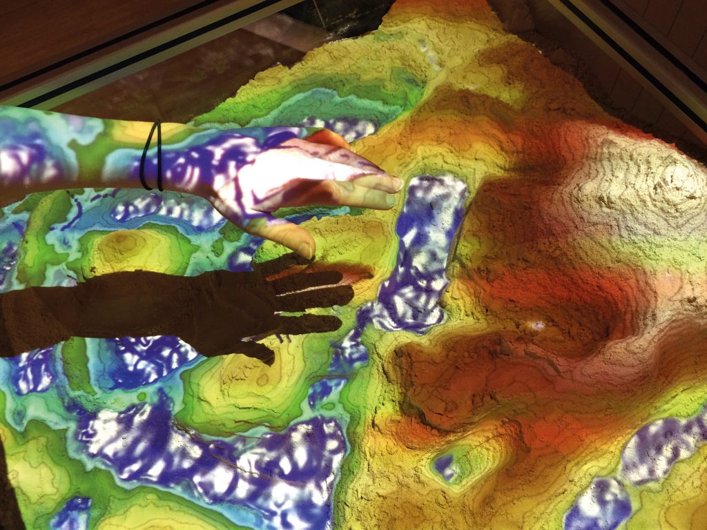
Visualisation of methods for remote sensing
Various methods are used to measure the surface of Earth or other celestial bodies from space using satellites – for example, in the TanDEM-X mission, radar signals are used to create an elevation profle of Earth’s surface. The signal transit times provide information about the topography – high and low areas, mountains and valleys. Other missions for example, use stereo cameras – as is the case of Mars Express – or lasers, as in the BepiColombo Mercury Planetary Orbiter. The data is utilised to generate three-dimensional maps, among other things.
The information obtained from other celestial bodies allows us to gain a better understanding of the formation of the Solar System and more precise conclusions regarding Earth’s past and future development. The maps also make it possible to identify scientifcally interesting and low-risk landing sites for future space missions, for example to the Moon or Mars.
The benefts of Earth remote sensing are even more obvious. The topographical data can be used, for example, to record the effects of climate change on sea levels and to identify flood-prone areas. It can even help save human lives. In the event of earthquakes or other natural disasters, the Center for Satellite Based Crisis Information (ZKI) at DLR provides special maps for rescue workers and assistance personnel within hours. Generated from a comparison of data from before and after the disaster, they show particularly affected areas and provide rescue workers with important information, for example, about which roads are still usable by vehicles.
The exhibit teaches schoolchildren in several DLR_School_Labs about techniques for remote sensing and their benefts. A computer records the surface in a sandpit with a Kinect sensor in precisely the same way that satellites scan Earth’s surface, and projects the colours typical for elevation profles onto the surface in real time. A key process for remote sensing is thus made tangible for children and young people.
German Aerospace Center (DLR)
Dirk Stiefs · E-Mail: dirk.stiefs@dlr.de · DLR.de/en
